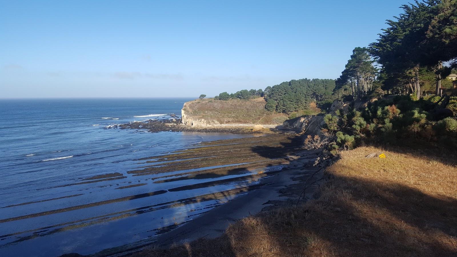
Bowling Ball Beach
Spherical sandstone boulders exposed only at low tide on a bluff-access beach three miles south of Point Arena.
Along Highway 1
Leg times are driving estimates along Highway 1.
South to north along Highway 1: Stewarts Point Store, then ~5 min to Sea Ranch Lodge, then ~15 min to Gualala Downtown, then ~25 min to Point Arena Downtown. Bowling Ball Beach is the venue on this page.
Nearby
A short drive
- Pelican Bluffs Trail 2.1 mi NW
- Izakaya Gama 3.1 mi NW
- Arena Market & Café 3.1 mi NW
- Sign of the Whale 3.1 mi NW
Beach
Bowling Ball Beach sits at the northern end of Schooner Gulch State Beach, about three miles south of Point Arena on Highway 1 (mile marker 11.41). The beach takes its name from rows of near-perfectly spherical sandstone concretions scattered across the sand and embedded in the eroding bluff — hard, round masses formed over millions of years as mineral cement bound grains of sand together, far more resistant to erosion than the softer mudstone that once surrounded them. Accounts of their size vary: most measure 2 to 5 feet across, though the largest reported examples run as big as 12 feet. Concretions like these are genuinely rare — similar formations turn up at Mushroom Rock State Park in Kansas, along North Dakota's Cannonball River, and in Kazakhstan's aptly named Valley of Balls — which makes this stretch of coast a real geological curiosity, not just a scenic overlook.
The catch: the boulders spend most of their time underwater. They're visible only at low tide, and a negative (minus) tide is what reveals full rows of stone spheres lined up along the sand. At high tide the beach narrows and the boulders disappear beneath the surf, so timing a visit to the tide chart isn't optional — it's the whole point of coming.
From the parking pullout on the west side of Highway 1, two trailheads lead down to the coast, and getting the right one matters: the northern trail crosses the bluff top toward Bowling Ball Beach, while the southern trail drops to Schooner Gulch Beach instead. Bowling Ball Beach can also be reached from Moat Creek Trail at its north end.
The walk in is short but not casual — about five minutes across the bluff top, then down a wooden stair-ladder that repeat visitors and the park itself describe as increasingly eroded after recent winter storms. Once on the sand, it's another five-minute walk to reach the main run of concretions, with around 100 visible at the lowest tides. The rocks are slippery, especially where they sit closer to the waterline, so climbing over them for a closer look takes real care. During a negative tide, the same low-water window that exposes the boulders also opens up good tidepooling among them.
Toward the north end of the beach, a break called Whiskey Shoals draws surfers, with both left and right breaks fed by offshore winds — best in spring and summer.
- Entry is free, with no permit required
- Parking is a small pullout on the west side of Highway 1 near mile marker 11.41 — look for the "Park facing South only" sign; blind curves in both directions make U-turns hazardous here
- Facilities are minimal — a pit toilet is available at the Schooner Gulch trailhead to the south, but there's nothing at the Bowling Ball Beach access point itself
- Dogs are allowed on leash, though the ladder descent and slick rocks make this a difficult outing for most dogs
- Visit on a weekday if you want the beach to yourself — weekends draw more visitors, especially around favorable low-tide windows
Bowling Ball Beach sits within Schooner Gulch State Beach, part of the Sonoma-Mendocino Coast District of California State Parks. The surrounding land has a long history: it lies within the traditional territory of the coastal Central Pomo people, was visited by Russian and Alaska Native hunters as early as 1812, passed through Mexican land grants in the 1840s, and was later logged and milled starting in the 1860s by John Galloway, whose family also ran the nearby Galloway School from 1874 to 1936. The land was sold to the State of California in 1986.
Nearby, Point Arena Lighthouse — at 115 feet, one of the tallest on the West Coast — is open for tours, and the town of Point Arena has galleries, shops, and the Center Street Market for sandwiches and picnic supplies. Point Arena–Stornetta Public Lands and Manchester State Park are both within easy reach for combining a longer coastal day.
Before You Go
- Check a tide chart before you leave — aim for low tide, ideally a negative tide, or you'll find little more than a narrow, submerged beach
- Wear sturdy, non-slip shoes — the concretions and surrounding rocks are slippery, and the stair-ladder descent has eroded in recent years
- Bring your own water and snacks — there are no facilities on the beach itself
- Come prepared for a real hike, not a stroll — a bluff-top walk, a ladder descent, and a scramble over uneven wet rock add up; Weekend Sherpa's write-up calls it "not for everyone"
- Watch the tide while you're down there — keep an eye on when it turns so you don't get caught at the wrong end of the beach as the water comes back in
- Leave the drone at home — drones are prohibited throughout this stretch of state park land
What visitors say
- Access, not the geology, is the sticking point — Weekend Sherpa flags the stair-ladder descent as hazardous after storm erosion and calls the outing "not for everyone"
- It gets more familiar with repeat visits — Hike Then Wine describes their first trip down requiring "just a rope to sort of scale down the side of the bluff," with later visits feeling more manageable
- Timing is the recurring frustration — multiple accounts stress that arriving outside a low or negative tide window means missing the concretions almost entirely
- Weekdays are quieter — Hike Then Wine's advice is to "try and go on a weekday if you can" for a better chance at having the place to yourself